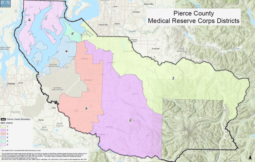
Pierce County Medical Reserve Corps serves 6 districts, each with its own supplies to respond to emergencies.
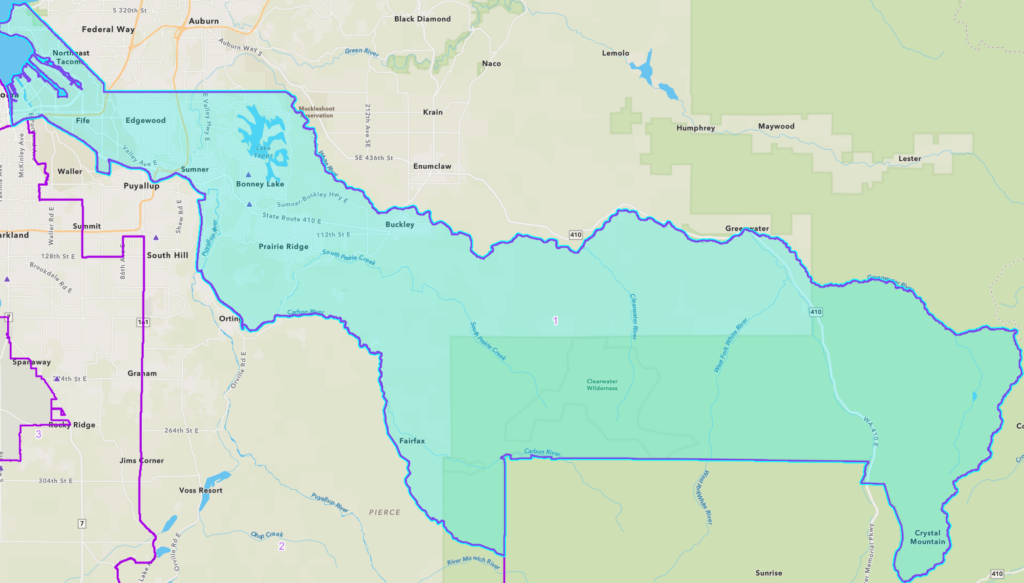
District 1
The portion of Pierce County lying north and east of a line beginning at the Puyallup River confluence with Commencement Bay, thence southeasterly along the Puyallup River to its junction with the Carbon River, thence southeasterly along the Carbon River to its junction with the western boundary of Mount Baker Snoqualmie National Forest, thence southerly along the western boundary of Mount Baker Snoqualmie National Forest to the Lewis County line.
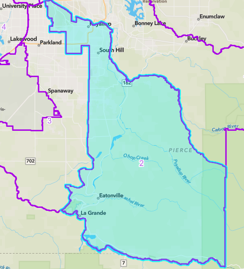
District 2
The portion of Pierce County lying south and east of a line beginning at the junction of the Puyallup River and Interstate 5, thence westerly along Interstate 5 to its junction with Portland Avenue, thence southerly along Portland Avenue to its junction with 72nd Street, thence easterly along 72nd Street to its junction with Canyon Road, thence southerly along Canyon Road to its junction with 176th Street near Fredrickson, thence easterly along 176th Street to its junction with Highway 161 (Meridian), thence southerly along Highway 161 to its junctions with Highway 7 (Mountain Highway) near Eatonville, thence southerly along Highway 7 to the Thurston County line, and, the portion of Pierce County lying west of a line beginning at the junction of Interstate 5 and the Puyallup River thence southeasterly along the Puyallup River to its junction with the Carbon River, thence southeasterly along the Carbon River to its junction with the western boundary of Mount Baker Snoqualmie National Forest, thence southerly along the western boundary of Mount Baker Snoqualmie National Forest to the Lewis County line.
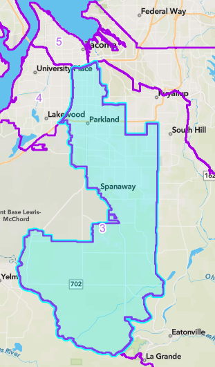
District 3
The portion of Pierce County that lies south and east of a line beginning at the junction of Interstate 5 and the Thurston County line, thence easterly along Interstate 5 to its junction with Portland Avenue, thence southerly along Portland Avenue to its junction with 72nd Street, thence easterly along 72nd Street to its junction with Canyon Road, thence southerly along Canyon Road to its junction with 176th Street near Fredrickson, thence easterly along 176th Street to its junction with Highway 161 (Meridian), thence southerly along Highway 161 to its junction with Highway 7 (Mountain Highway) near Eatonville, thence southerly along Highway to the Thurston County line, with the exception of Joint Base Lewis-McChord.
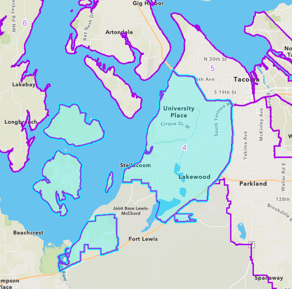
District 4
The portion of Pierce County that lies north and west of a line beginning at Thurston County on Interstate 5, thence northerly along Interstate 5 to its junction with Highway 16, thence northwesterly along Highway 16 to the Tacoma Narrows Bridge.
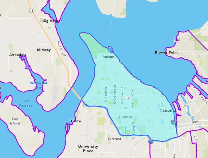
District 5
The portion of Pierce County lying north and east of a line beginning at the Tacoma Narrows Bridge and Highway 16, thence along Highway 16 to its junction with Interstate 5, thence easterly along Interstate 5 to its junction with the Puyallup River.
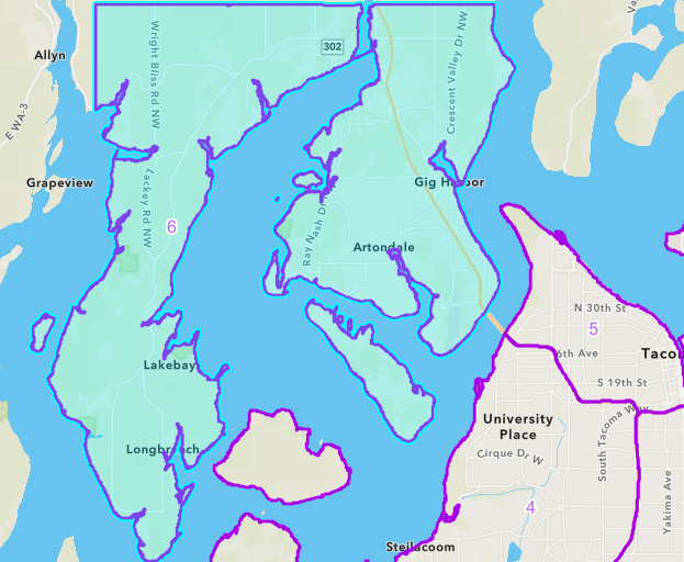
District 6
The portion of Pierce County lying west of the Tacoma Narrows Bridge, including Gig Harbor and Key Peninsula.